
{“content_html”:”
Product Overview
n
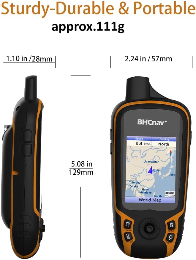
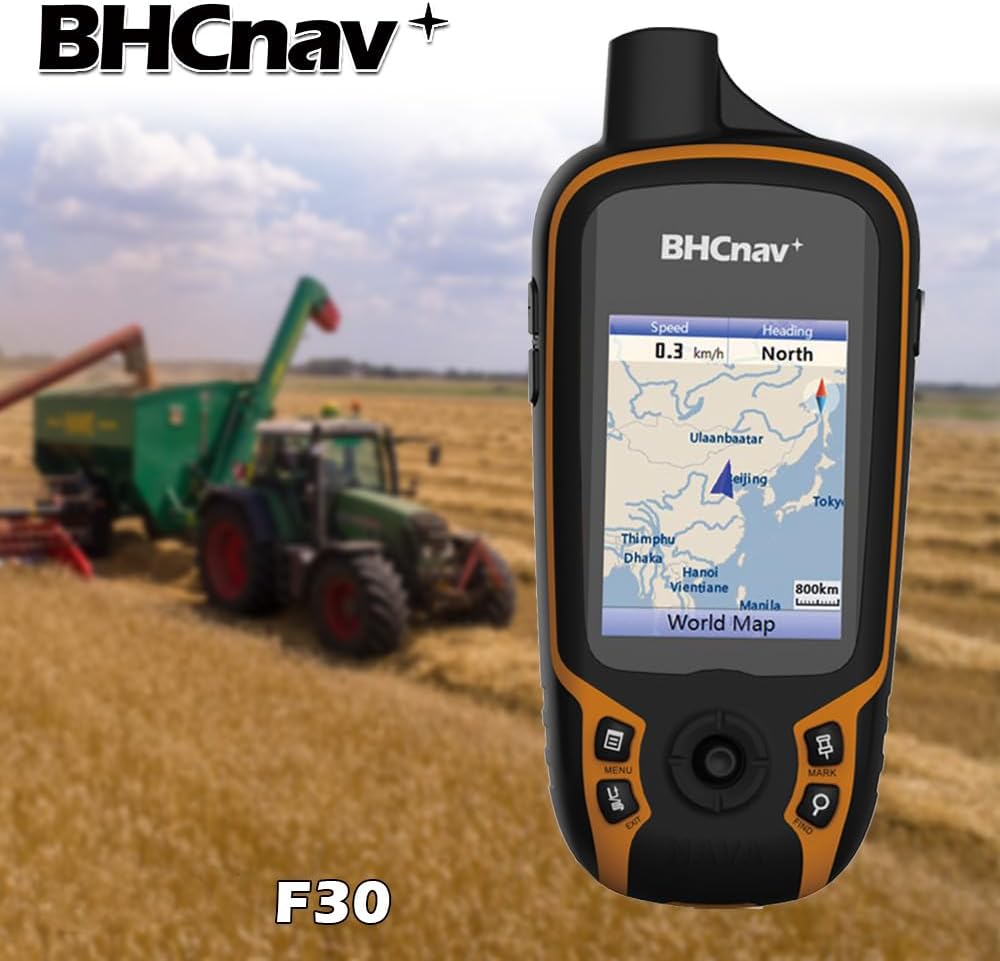
The NAVA F30 is a rugged handheld GPS navigation device designed for outdoor enthusiasts and professionals who need reliable positioning in challenging environments. Built to support both GPS and GLONASS satellite systems, this device delivers accurate location data across diverse terrains—from hiking trails and forest surveys to agricultural mapping and land measurement tasks. Its durable construction ensures performance in harsh conditions, while the sunlight-readable display keeps information clear in bright outdoor settings. With support for multiple map formats and extensive data export capabilities, the NAVA F30 serves as a versatile tool for surveying, geocaching, travel planning, and fieldwork.
nn
Key Features
n
- n
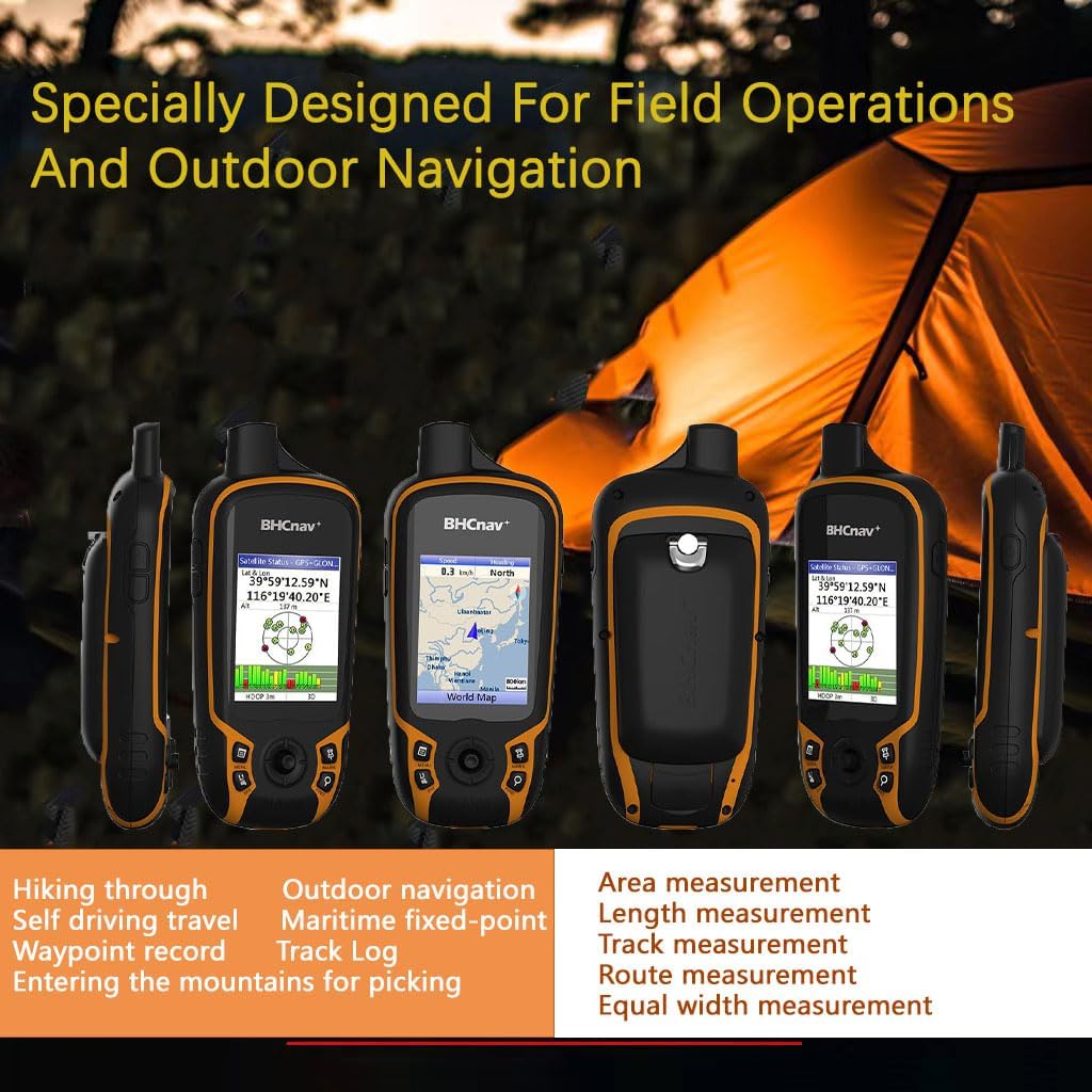
- Rugged Design for Outdoor Use: Engineered for durability, the NAVA F30 is built to withstand tough outdoor conditions commonly encountered during hiking, hunting, camping, and professional surveying missions.
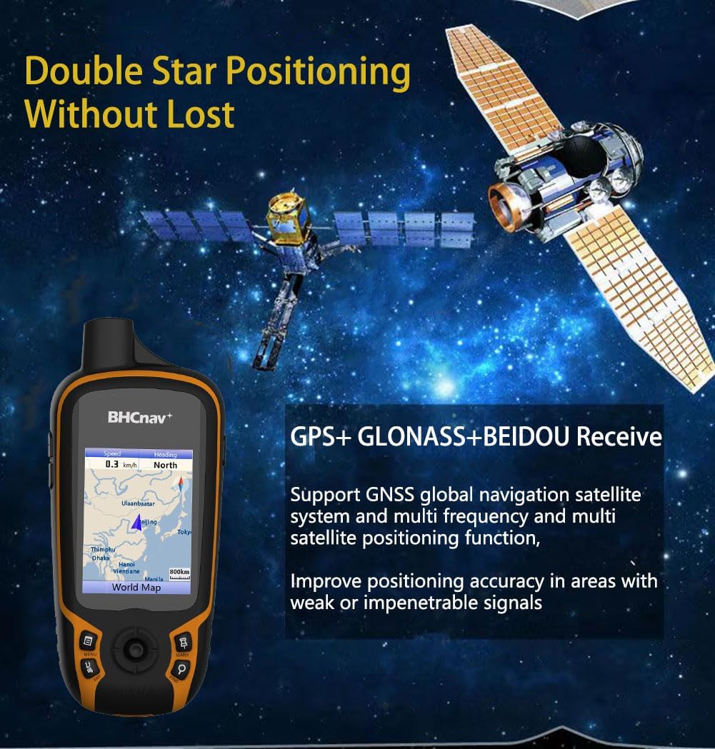
- Dual Satellite System Support: Receives signals from both GPS and GLONASS satellites, enhancing accuracy and reliability especially in areas with limited sky visibility such as dense forests or mountainous regions.
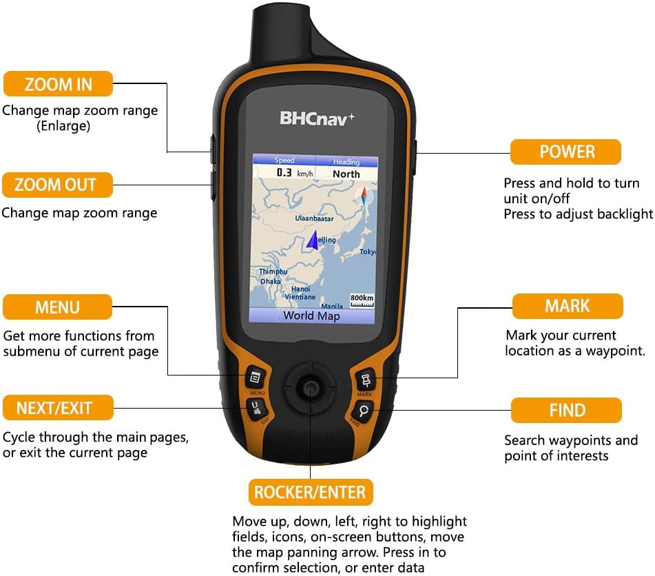
- Colorful Transflective Display: Features a 2.2-inch QVGA (240×320 pixel) color screen that remains visible under direct sunlight, ensuring clear readability during extended use outdoors.
- Expandable Memory Storage: Comes with 4 GB internal memory and supports microSD/TF cards up to 32 GB, allowing users to store detailed maps, waypoints, tracks, and routes without running out of space.
- Preloaded Worldwide Basemap: Includes a global basemap out of the box, with options to download additional vector, DEM (Digital Elevation Model), and raster maps for enhanced navigation and analysis.
- Power Efficient Operation: Operates on two AA batteries for up to 20 hours of continuous use, making it suitable for long expeditions without frequent battery changes.
- Four Language Interface: User interface available in English, French, Spanish, and Portuguese to accommodate international users.
- PC Software Integration: Works with NAVA GPS Office software for efficient management, editing, and transfer of waypoints, tracks, and routes between the device and a computer.
- Paperless Geocaching Support: Enables digital geocaching adventures by storing caches offline and syncing with compatible platforms.
n
n
n
n
li>Multiple Data Format Compatibility: Supports importing and exporting data in GPX, SHP, MIF, CSV, KML, DXF, and TXT formats, enabling seamless integration with GIS software and other mapping applications.
n
n
n
n
n
nn
Technical Specifications
n
- n
- Display: 2.2″ QVGA transflective color LCD, 240 x 320 pixels
- Memory: 4 GB internal + microSD/TF card slot (supports up to 32 GB)
- Battery: 2 x AA batteries (up to 20 hours runtime)
- Satellite Systems: GPS + GLONASS + BeiDou (BeiDou support mentioned as included)
- Maps Supported: Worldwide basemap preinstalled; compatible with vector, DEM, and raster map downloads
- Data Formats: GPX, SHP, MIF, CSV, KML, DXF, TXT
- Languages: English, French, Spanish, Portuguese
- Dimensions & Weight: Not specified in source
- Operating Temperature: Not specified in source
- Water/Dust Resistance: Not specified in source
n
n
n
n
n
n
n
n
n
n
nn
Benefits & Use Cases
n
The NAVA F30 excels in scenarios requiring precise outdoor navigation and spatial data collection. Professional land surveyors will appreciate its compatibility with standard GIS formats like SHP and KML, which simplifies data sharing and reporting. Hikers and backpackers benefit from the clear daylight screen and long battery life during multi-day treks. Agricultural workers can utilize it for field boundary marking and crop monitoring. Similarly, forestry professionals and miners rely on accurate positioning for site mapping and safety planning. The ability to load custom maps also makes it valuable for urban explorers or travelers seeking city-level detail maps not covered by the base layer. With paperless geocaching support, amateur treasure hunters can fully digitize their searches using stored coordinates and clues.
nn
Important Notes
n
The product includes OEM services, meaning custom branding or configuration may be available upon request depending on supplier agreement. While the device supports BeiDou alongside GPS and GLONASS, specific performance details under BeiDou are not provided. No waterproof rating is listed, so exposure to heavy rain or submersion should be avoided unless further specifications confirm protection. The inclusion of free downloadable maps implies access to an online resource but does not guarantee permanent availability or updates. Always verify current map availability through official channels before deployment. Package contents are not detailed beyond the main unit, so buyers should confirm accessories included if needed for immediate operation.
nn


 “,”focus_keyword”:”handheld GPS navigation device”,”seo_title”:”NAVA F30 Handheld GPS Navigator”,”meta_description”:”Rugged handheld GPS device with GPS/GLONASS/BeiDou support, sunlight-readable screen, expandable storage, and GIS data export for outdoor adventures and surveying.”}


 Adjustable Turbo")